

Read the first chapter
The whole of chapter one, free. About 19 min. Turn the pages with the arrows, your keyboard, or a swipe.
Chapter 1
Lost Cities Beneath the Sand
Overview
A city can disappear without vanishing completely: its streets may hide under ash, its houses beneath sand, and its name inside an old poem. Facts #1 - #50 follow the clues archaeologists use to find Pompeii, Troy, Petra, and other buried or forgotten settlements.
As you read, act like a history detective. Look for roads, walls, wells, tools, food, writing, and sudden layers of earth. Each clue helps answer one question: how did people live, and why did their city disappear?
The Breakdown
#1: Pompeii Was Buried by Mount Vesuvius
Problem: Pompeii was a busy Roman city near Mount Vesuvius. In AD 79, the volcano erupted and buried the city under ash and rock, hiding streets and homes from view.
Solution: Archaeologists studied the thick volcanic layers and carefully uncovered buildings, shops, and roads. They compared the objects found in each layer to learn what happened first and what came later.
Result: Pompeii became one of the clearest snapshots of Roman daily life. Its buried streets still show where people worked, shopped, worshiped, and lived.
#2: Ash Preserved Wooden Objects
Problem: Wood usually rots away after people abandon a city. At Pompeii, hot ash covered wooden doors, furniture, and beams before air and water could destroy them.
Solution: Archaeologists record the position of each object before moving it. They also protect fragile wood with special supports and treatments.
Result: Visitors can learn how Roman homes were built and furnished. A wooden doorway can reveal as much about a family as a stone statue.
#3: Pompeii’s Streets Had Raised Footpaths
Problem: Rainwater and dirty runoff often flowed along Pompeii’s streets. Walking through the road could mean stepping into mud or waste.
Solution: Builders raised sidewalks beside many streets and placed stepping stones across some roads. The spaces between the stones were wide enough for wagon wheels.
Result: The street design shows that Pompeii had practical systems for movement and drainage. The stones also help archaeologists understand how carts traveled through the city.
#4: Mount Vesuvius Was Not Always Thought to Be a Volcano
Problem: Before AD 79, Vesuvius looked like an ordinary mountain covered with plants. Many residents had no reason to expect a huge eruption.
Solution: Historians compare descriptions by the Roman writer Pliny the Younger with the volcanic layers found underground. This combination of written evidence and physical evidence helps reconstruct the disaster.
Result: Pompeii teaches an important detective lesson: landscapes can hide danger, and old eyewitness accounts can help explain what the ground reveals.
#5: Pliny the Younger Described the Eruption
Problem: Few people left detailed written accounts of the eruption. Without eyewitness descriptions, it would be harder to understand the cloud of ash and the movement of the sea and sky.
Solution: Historians study letters written by Pliny the Younger, who watched the eruption from across the Bay of Naples. His account describes a tall, spreading cloud often compared with a pine tree.
Result: His letters became a valuable source for studying the eruption. They also helped give the eruption style called “Plinian” its name.
#6: Ash Made Human Shapes
Problem: The people who died at Pompeii disappeared beneath ash, but their bodies later decayed. Empty spaces remained inside the hardened material.
Solution: In the nineteenth century, archaeologists poured plaster into some of these spaces. The plaster filled the hollows and showed the positions of clothing, arms, and other details.
Result: The casts reveal the final moments of some victims. They must be treated with care because they represent real people, not ordinary statues.
#7: Pompeii Had Fast-Food Counters
Problem: Not every Roman home had a large kitchen. Workers, travelers, and busy residents needed quick meals.
Solution: Archaeologists examine counters called thermopolia, where hot food and drinks were served. Clay containers set into the counters could hold stews, beans, or other prepared foods.
Result: These shops show that eating away from home is not a new idea. Pompeii’s streets had small businesses much like modern takeaway places.
#8: Graffiti Reveals Ordinary Voices
Problem: Official statues and government buildings mostly show what powerful people wanted remembered. They do not tell the whole story of a city.
Solution: Archaeologists read short messages scratched or painted on Pompeii’s walls. These include election notices, advertisements, jokes, greetings, and personal messages.
Result: Graffiti gives historians a closer look at everyday voices. It proves that writing was used for more than books and laws.
#9: Pompeii Had Election Notices
Problem: A city’s political life can disappear when its buildings collapse. Without small clues, we might know only the names of rulers, not local candidates.
Solution: Researchers study painted notices on house walls. Some ask neighbors to support particular candidates for town offices.
Result: These notices show that Pompeii had local elections and public arguments. They also reveal which homes and streets were connected with political activity.
#10: A Bakery Preserved Loaves of Bread
Problem: Food usually spoils quickly, leaving little evidence of what people ate. The eruption at Pompeii changed that.
Solution: Archaeologists found bakeries with ovens, grinding stones, and carbonized loaves. Carbonized means that intense heat turned the bread into a black, preserved form rather than ordinary ash.
Result: The bakeries show that bread production was organized and busy. The loaves also provide clues about Roman meals and work.
#11: Herculaneum Was Buried Differently
Problem: Herculaneum, another town near Vesuvius, did not receive exactly the same kind of covering as Pompeii. A fast, hot flow of volcanic material buried it deeply.
Solution: Archaeologists compare the layers at Herculaneum with those at Pompeii. They study the thickness, texture, and contents of each layer.
Result: The comparison shows that one eruption can affect nearby places in different ways. Herculaneum preserved many upper floors and wooden objects unusually well.
#12: Herculaneum’s Scrolls Were Burned
Problem: A library at Herculaneum contained scrolls damaged by extreme heat. Opening them by force could destroy the writing forever.
Solution: Researchers use imaging methods, including special scans, to look inside some scrolls without unrolling them. Computer programs can help separate the layers of the rolled material.
Result: Hidden words may be recovered without tearing the scrolls apart. This is a modern tool helping solve an ancient mystery.
#13: The Villa of the Papyri Held a Library
Problem: Many ancient books vanished because papyrus decays or burns. A library surviving from the Roman world is therefore extremely rare.
Solution: Archaeologists explored the Villa of the Papyri at Herculaneum, where hundreds of rolled manuscripts were found. They identified the collection by examining the shape and material of the scrolls.
Result: The villa offers clues about Roman reading and collecting. It also reminds us that a buried city may preserve ideas as well as buildings.
#14: Troy Was Known Through a Poem
Problem: Troy was famous in Homer’s Iliad, but a poem is not a map with exact street names. For many years, people debated whether the city had truly existed.
Solution: Archaeologists searched for a settlement in northwestern Anatolia, near modern Hisarlik in Türkiye. They compared the ruins with clues from ancient stories and other historical evidence.
Result: Several settlements were found on the same hill. Troy was not just one layer but a city rebuilt many times.
#15: Troy Had Many Layers
Problem: A city built, destroyed, and rebuilt in the same place can confuse investigators. Walls from different periods may sit directly above one another.
Solution: Archaeologists label the layers and study pottery, walls, tools, and building styles. A change in materials can show when one settlement ended and another began.
Result: The layers of Troy act like pages in a book. Reading them reveals thousands of years of settlement history.
#16: Heinrich Schliemann Excavated Troy
Problem: Heinrich Schliemann believed Troy lay at Hisarlik, but his digging methods caused damage to some layers. Removing earth too quickly can destroy the clues that explain it.
Solution: Later archaeologists used more careful methods, recording each layer and object in place. They also corrected some of Schliemann’s early conclusions.
Result: Schliemann helped bring Troy to wider attention, while later teams showed why careful excavation matters. Finding a city is only the beginning; understanding it requires patience.
#17: “Priam’s Treasure” Has a Complicated Story
Problem: Schliemann called a collection of gold objects “Priam’s Treasure,” linking it to the legendary king of Troy. The objects may come from a different period than the war described in the poem.
Solution: Researchers compare the treasure’s style and location with the layers of the site. They avoid naming objects after famous characters unless the evidence supports the connection.
Result: The treasure remains important, but its label is not proof. This teaches us to separate an exciting story from a tested conclusion.
#18: Troy Was Near Important Water Routes
Problem: A city’s location can explain its wealth, conflicts, and growth. Troy stood near routes connecting the Aegean Sea with the Sea of Marmara and the Black Sea region.
Solution: Archaeologists study the landscape as well as the ruins. They examine walls, storage areas, imported pottery, and the distance to ancient shorelines.
Result: Troy’s position helps explain why it mattered. Geography can be one of the strongest clues in a historical mystery.
#19: Troy Had Strong Defensive Walls
Problem: A city exposed to attack needed more than houses. Thick walls and gates could protect people, supplies, and rulers.
Solution: Investigators measure wall foundations and compare their construction with other Bronze Age settlements. They look for towers, gates, ditches, and repairs.
Result: Troy’s defenses show that protection was a major concern. Rebuilt walls also reveal periods when the city faced danger or changed its plans.
#20: The Trojan Horse May Be a Story Clue
Problem: The famous wooden horse is difficult to prove through archaeology because wood rots and stories can change over time. A literal horse may not be the only explanation.
Solution: Historians compare the poem with possible military meanings, such as a siege machine, a ship, or a symbol connected with a god. They keep several explanations open when direct evidence is missing.
Result: The horse remains a memorable mystery rather than a confirmed object. Good history allows questions to remain questions.
#21: Petra Was Carved Into Rock
Problem: Petra can look like a city of free-standing buildings, but many famous structures were cut directly into rose-colored sandstone cliffs.
Solution: Archaeologists inspect tool marks, doorways, chambers, and unfinished surfaces. These details show how workers removed stone and shaped facades.
Result: Petra’s rock-cut buildings reveal both skill and planning. The cliffs were not just scenery; they were part of the city’s architecture.
#22: Petra Was a Nabataean Capital
Problem: Petra is sometimes described only as a Roman site, which hides the people who built its earliest greatness. The Nabataeans controlled the city before Rome took power there.
Solution: Researchers study inscriptions, pottery, tombs, coins, and building styles connected with the Nabataeans. They also compare Petra with other settlements in the region.
Result: Petra’s history includes a powerful Arab kingdom with its own traditions. The city’s story did not begin when Roman influence arrived.
#23: Petra Controlled Trade Routes
Problem: Caravans carrying spices, incense, textiles, and other goods needed safe routes and places to rest. A city in a dry landscape had to connect travelers with water and shelter.
Solution: Archaeologists map roads, storage spaces, markets, and caravan stops. They study imported objects to trace links between Petra and distant regions.
Result: Petra grew wealthy by helping goods move across deserts. Its location shows how trade can turn a difficult landscape into a busy center.
#24: Petra’s Water System Defied the Desert
Problem: Petra receives little rain, and sudden floods can rush through narrow valleys. A large city could not survive there without careful water control.
Solution: Nabataean engineers built channels, dams, cisterns, and pipes. Archaeologists trace these features to learn how water was collected, stored, filtered, and moved.
Result: Petra supported homes, gardens, animals, and travelers. Its water system was as important as its famous stone facades.
#25: The Siq Leads Into Petra
Problem: The main entrance to Petra passes through a narrow gorge called the Siq. Such a passage could hide the city from travelers and make movement difficult.
Solution: Researchers examine the carved walls, paving, channels, and old water pipes along the route. They use these clues to understand how people entered the city.
Result: The Siq was both a natural entrance and an engineered roadway. Its shape helped protect Petra while guiding visitors toward its center.
#26: Petra’s Treasury Was Probably a Tomb
Problem: The building called the Treasury looks like a royal storehouse, but its name comes from a later story, not firm evidence that treasure was kept inside.
Solution: Archaeologists study the interior chambers, carvings, and nearby burials. They compare the building with other Nabataean tombs.
Result: Evidence suggests the Treasury was likely a tomb or memorial. Its grand front shows how architecture could honor the dead.
#27: Petra Had a Theater
Problem: A desert city might be wrongly imagined as a small trading camp. Petra had public buildings that supported a large and organized population.
Solution: Archaeologists examine the theater’s seating, stage area, and construction. They compare its design with theaters in the wider Roman world while noting local features.
Result: The theater shows that Petra’s residents gathered for public performances or events. It adds community life to the picture of a trade city.
#28: Petra Changed Under Roman Rule
Problem: When Rome took control of Petra in AD 106, the city did not instantly become a completely different place. Old traditions and new influences existed together.
Solution: Researchers compare Roman roads, coins, buildings, and inscriptions with earlier Nabataean features. They track changes rather than assuming one culture simply replaced another.
Result: Petra’s ruins show cultural mixing over time. Cities often change through contact, not through one sudden switch.
#29: Petra Was Not Simply “Lost”
Problem: Petra is often called a lost city, but local people continued to know the area after its ancient importance declined. The word “lost” can make history sound more mysterious than it really was.
Solution: Historians study later travelers, local traditions, and continued use of the landscape. They distinguish between a city losing power and a place being completely unknown.
Result: Petra’s story becomes more accurate and respectful. A city can fade from international attention without disappearing from local memory.
#30: Desert Sand Can Preserve Buildings
Problem: Wind and sand can damage stone, but sand can also cover walls and protect them from later building and weathering. Buried ruins may survive for centuries.
Solution: Archaeologists remove sand in measured layers and record every wall, doorway, and object. They avoid clearing large areas without mapping the site first.
Result: Sand becomes both a destroyer and a time capsule. Careful digging can reveal a settlement’s plan piece by piece.
#31: Ancient Roads Point to Settlements
Problem: A buried city may have few buildings visible at the surface. Roads, however, often connect places that needed regular travel.
Solution: Archaeologists follow straight embankments, worn tracks, paving stones, and bridge remains. Aerial photographs and satellite images can reveal lines hidden by crops or sand.
Result: Roads help investigators predict where homes, gates, markets, and farms may lie. They show how a settlement fit into a larger region.
#32: Walls Reveal City Boundaries
Problem: A pile of stones does not always look like a planned settlement. Without identifying walls, it is difficult to tell where a city began or ended.
Solution: Researchers look for repeated building patterns, corners, gates, and foundations. They compare wall thickness and materials to decide whether a wall protected a city, supported a house, or held back water.
Result: Walls reveal boundaries and purpose. They can show whether a place was a fortress, a neighborhood, or a much larger city.
#33: Wells Identify Daily Needs
Problem: People cannot live long without dependable water. A settlement with houses but no water source may have been temporary or connected to a hidden system.
Solution: Archaeologists search for wells, springs, cisterns, pipes, and channels. They test soil and stone deposits for signs of long-term water use.
Result: Water clues help estimate how many people lived in a place. They also explain why a settlement grew in one location rather than another.
#34: Pottery Helps Date Ruins
Problem: A broken wall can be hard to date because building methods may stay similar for centuries. Pottery styles often changed more quickly.
Solution: Archaeologists compare shapes, clay, paint, and decorations with pottery from known periods. They record where each fragment was found instead of treating all pieces as one group.
Result: A small shard can help place a house or road on a timeline. Pottery is one of archaeology’s most useful dating clues.
#35: Coins Track Rulers and Trade
Problem: A coin found in a ruin may have traveled far from the place where it was made. It can still provide clues about trade, authority, and time.
Solution: Researchers examine portraits, symbols, writing, metal, and wear. They record the coin’s exact location and compare it with other finds.
Result: Coins can connect a settlement with distant rulers and markets. They may also show when a city used money or came under new control.
#36: Seeds Reveal Ancient Meals
Problem: Written records may list grand feasts but say little about ordinary meals. Food remains can reveal what most people actually grew and ate.
Solution: Archaeologists collect soil samples from floors, ovens, storage rooms, and drains. Specialists identify charred seeds, grains, fruit pits, and animal bones.
Result: Tiny remains can reveal farming, cooking, and trade. A burnt seed may tell a more ordinary and useful story than a royal inscription.
#37: Pollen Maps Ancient Landscapes
Problem: Modern plants may hide how a place looked long ago. A dry settlement today might once have stood beside fields, forests, or gardens.
Solution: Scientists study pollen preserved in soil, lake beds, and other protected places. Different plants leave recognizable pollen grains.
Result: Pollen helps rebuild ancient landscapes. It can show whether people cleared forests, planted crops, or lived through a changing climate.
#38: Animal Bones Show Work and Food
Problem: Finding animal bones does not automatically tell us whether people ate the animals. Bones might come from pets, sacrifices, hunting, or work animals.
Solution: Researchers examine cut marks, burning, age, and bone location. They compare these clues with butcher shops, kitchens, stables, and religious spaces.
Result: Animal remains reveal diets and jobs. They can show whether a settlement depended on farming, herding, hunting, or trade.
#39: Human Waste Can Reveal Health
Problem: Diseases and diets often leave no clear mark on buildings. Yet ancient waste may preserve seeds, parasites, and other evidence.
Solution: Archaeologists study deposits from toilets, drains, and soil layers using microscopes and laboratory tests. They handle the material carefully and record its location.
Result: Waste can reveal what people ate, which parasites affected them, and how sanitation worked. Even unpleasant clues can answer important questions.
#40: Lidar Sees Through Forest Cover
Problem: Thick forests can hide roads, terraces, and buildings from people walking on the ground. Ordinary photographs may show only trees.
Solution: Lidar, short for light detection and ranging, sends laser pulses from an aircraft or drone toward the ground. The returning signals can create a three-dimensional map of hidden shapes.
Result: Lidar has helped reveal ancient roads and settlements beneath vegetation. It lets archaeologists search large areas without cutting down the forest.
#41: Satellite Images Find Buried Patterns
Problem: A buried wall may be invisible at ground level but affect the plants growing above it. A crop over a shallow wall may grow differently from a crop over a filled ditch.
Solution: Researchers compare satellite images taken at different times and in different kinds of light. They mark unusual lines, rectangles, and circles for ground investigation.
Result: Images from space can guide archaeologists toward hidden sites. They do not replace digging, but they make the search faster and more focused.
#42: Ground-Penetrating Radar Maps Subsurface Features
Problem: Digging everywhere would damage ruins and take far too long. Investigators need a way to look below the surface first.
Solution: Ground-penetrating radar sends radio waves into the ground and records reflections from walls, floors, and empty spaces. Archaeologists use the results to plan small test trenches.
Result: Hidden rooms and streets can be mapped with less digging. The method protects the site while providing a useful underground picture.
#43: Aerial Photos Reveal Ancient Field Lines
Problem: Ancient farms may disappear when later people plow or build over them. Their boundaries can survive only as faint lines in the soil.
Solution: Archaeologists study photographs taken from above, especially when sunlight creates shadows across low ridges. They compare the lines with known roads, canals, and settlement remains.
Result: Field patterns show how a city fed itself. They can reveal farms even when the houses have vanished.
#44: Inscriptions Name Forgotten Places
Problem: A ruin may be impressive but impossible to identify if its ancient name is unknown. Similar buildings in different regions can cause confusion.
Solution: Specialists copy inscriptions, identify the language, and compare names with old maps and written records. They record the exact location because a text’s position can explain its purpose.
Result: A few carved words can connect ruins to rulers, gods, workers, or towns. Writing turns anonymous stones into named parts of history.
#45: Ancient Languages Need Careful Reading
Problem: A damaged inscription may have missing letters or several possible meanings. Translating too quickly can create a false story.
Solution: Experts compare the text with other examples of the same language and period. They mark uncertain letters instead of pretending every word is clear.
Result: Careful translation protects the truth. It also shows that solving history often means accepting what remains unknown.
#46: A City Can Be Abandoned Slowly
Problem: People often expect a vanished city to have ended in one dramatic event. Some settlements emptied over decades because of trade changes, drought, disease, or political trouble.
Solution: Archaeologists look for signs of gradual decline, such as repaired buildings, fewer imported goods, shrinking neighborhoods, and abandoned wells. They compare layers from different parts of the city.
Result: The evidence can show a slow departure rather than one sudden disaster. A city’s final chapter may be quiet but still important.
#47: Earthquakes Can Reshape Settlements
Problem: An earthquake can knock down walls, block roads, and change water channels. Later residents may rebuild directly over the damage.
Solution: Investigators look for walls fallen in the same direction, cracked floors, broken pottery, and sudden repair layers. They compare these signs with known earthquake activity in the region.
Result: Earthquake damage can explain why a neighborhood changed or why a city moved. It also separates natural destruction from human conflict.
#48: Floods Leave Special Clues
Problem: Floodwater can bury streets and homes, but not every layer of mud comes from a flood. Windblown sand, building debris, and river deposits may look similar.
Solution: Archaeologists examine grain size, water marks, shells, plant remains, and the direction in which objects settled. They study the surrounding river or valley to test the explanation.
Result: Flood layers can reveal how rivers shaped settlements. They may explain why people raised floors, built embankments, or moved to higher ground.
#49: Archaeologists Record Before Removing
Problem: An object taken from the ground without notes loses much of its meaning. A pot is useful, but knowing whether it sat in a kitchen, grave, shop, or road is even more useful.
Solution: Archaeologists photograph and map each find before lifting it. They record its depth, nearby objects, soil layer, and condition.
Result: The object keeps its story instead of becoming an isolated treasure. Context is the clue that connects separate pieces of evidence.
#50: Lost Cities Are Solved by Many Clues
Problem: No single clue can usually explain a vanished settlement. A wall might show defense, but it cannot by itself reveal when people left or what they believed.
Solution: Combine evidence from roads, walls, water systems, pottery, coins, food remains, inscriptions, landscape studies, and written accounts. Ask whether different clues support the same explanation, and keep alternative explanations until the evidence becomes stronger.
Result: The best discoveries come from patient teamwork rather than one dramatic guess. Buried cities become understandable when small clues are placed together, like pieces of a very old puzzle.
What Comes Next
The next chapter follows another kind of mystery: ancient inventions, from clever machines to everyday tools that changed how people lived. Keep your detective skills ready - an invention’s design can be a clue to the problems its makers wanted to solve.
End of chapter one. 9 more chapters and about 41,992 words in the full book.
Swipe or use the arrows to turn the page


What's inside: 10 chapters
- 1. Lost Cities Beneath the Sand
- 2. Cities Swallowed by Jungle, Water, and Time
- 3. Ancient Inventions That Changed Everyday Life
- 4. Brilliant Machines and Bold Engineering
- 5. Explorers Who Followed the Unknown
- 6. Voyages Across Oceans and Around the World
- 7. Mysterious Objects and Archaeological Clues
- 8. Codes, Maps, and Messages from the Past
- 9. Surprising Lives of Kings, Kids, and Everyday People
- 10. History’s Unsolved Questions and New Discoveries
About this book
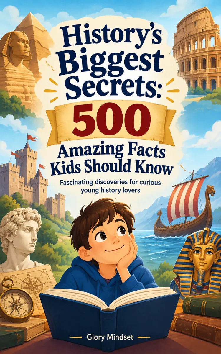
"History’s Biggest Secrets: 500 Amazing Facts Kids Should Know" is a list book by Glory Mindset with 10 chapters and approximately 41,992 words. Five hundred surprising facts about lost cities, inventions, explorers, and historical mysteries.
This book was created using Inkfluence AI, an AI-powered book generation platform that helps authors write, design, and publish complete books.
Frequently Asked Questions
What is "History’s Biggest Secrets: 500 Amazing Facts Kids Should Know" about?
Five hundred surprising facts about lost cities, inventions, explorers, and historical mysteries
How many chapters are in "History’s Biggest Secrets: 500 Amazing Facts Kids Should Know"?
The book contains 10 chapters and approximately 41,992 words. Topics covered include Lost Cities Beneath the Sand, Cities Swallowed by Jungle, Water, and Time, Ancient Inventions That Changed Everyday Life, Brilliant Machines and Bold Engineering, and more.
Who wrote "History’s Biggest Secrets: 500 Amazing Facts Kids Should Know"?
This book was written by Glory Mindset and created using Inkfluence AI, an AI book generation platform that helps authors write, design, and publish books.
Write your own list book with AI
Describe your idea and Inkfluence writes the whole thing. Free to start.
Start writingCreated with Inkfluence AI


