

Read the first chapter
The whole of chapter one, free. About 7 min. Turn the pages with the arrows, your keyboard, or a swipe.
Chapter 1
Why Memphis Rose on a Bluff
The Ground Beneath Memphis
A riverboat approaching Memphis does not first meet a city. It meets a wall of earth: the Chickasaw Bluff, rising above the Mississippi floodplain. That height was not scenery. It was the reason a settlement could survive where water regularly rearranged the land below.
The city founded here in 1819 was placed on a natural platform with commanding views, firmer ground, and access to the river. Later, cotton warehouses, rail lines, and an airport would follow the same logic. Different technologies arrived, but the geography kept making the same argument.
Memphis did not rise because the location was convenient in some vague sense. It rose because transportation systems repeatedly rewarded the same narrow strip of high ground. That pattern - what this book calls The High-Ground Advantage - begins long before modern property records, but it helps explain why those records still matter.
How much of Memphis’s future was already written into the shape of the land?
The Bluff Before the City
The Chickasaw Bluff is part of a chain of elevated land along the eastern side of the Mississippi River. Memphis sits on the fourth bluff, a rise that protected the settlement from the river’s ordinary flooding. The surrounding lowlands were fertile, but fertility alone does not make a city. A city also needs a place where buildings, roads, storage, and people can remain in place when the river expands.
The Mississippi is not a polite boundary. It shifts channels, deposits silt, cuts banks, and turns flat ground into temporary ground. From the bluff, the river could be reached without placing the settlement itself inside the floodplain. That distinction mattered to Indigenous communities, traders, soldiers, and later merchants who needed both water access and stable land.
Before 1819, the bluff was connected to the Chickasaw homeland and to a wider network of movement through the river valleys. The name preserved that connection even as American settlement transformed the area. The land was not empty before Memphis was founded. It was already part of a lived landscape, and its strategic value was recognized long before a municipal boundary appeared on a map.
In 1819, Memphis was founded as a town on that elevated ground. Its founders were not choosing a random point beside the river. They were choosing a place where river traffic, overland movement, and defensible terrain met. The city’s original advantage was physical before it was commercial.
Twelve Cents and a City
The political change that opened the region to American development came through the Jackson Purchase. In 1818, the United States acquired lands west of the Tennessee River from the Chickasaw, and the area that would become Memphis entered a new period of forced transfer and settlement. In 1819, land in the purchase could be obtained for $0.12 per acre.
That price is difficult to separate from the violence and dispossession behind it. Cheap land was not simply an economic opportunity. It reflected a government-backed process that transferred Indigenous territory into the hands of American settlers and speculators. The future city was built on a bargain that was cheap for purchasers because the cost was imposed on someone else.
The bluff gave the new town an immediate advantage over lower river settlements. A landing could serve boats. The higher ground could hold streets and buildings. The river connected Memphis to New Orleans, St. Louis, and the interior South, while the land behind the bluff opened toward farms and plantations.
The arrangement was simple enough to understand without a map: goods moved toward the river, people and supplies moved away from it, and the bluff held the city between those directions. Memphis was a hinge between water and land.
The city’s early growth also carried a contradiction. The same river that made Memphis accessible made it vulnerable to disease, flood, and economic dependence. The same land that supported commerce became valuable to those who could claim, divide, lease, and inherit it. Geography created the opportunity. Ownership determined who could use it.
Cotton Finds the High Ground
By the nineteenth century, Memphis had become tied to the cotton economy. Cotton moved toward the river from plantations across the Mid-South, and Memphis became a place where it could be stored, priced, financed, and shipped. The bluff was useful because warehouses and commercial streets could stand above the floodplain while remaining close to river landings.
Cotton did not need Memphis because the city was beautiful. It needed Memphis because the city connected production to transportation. Bales came in from the countryside, passed through warehouses, and moved downriver toward national and international markets. The bluff gave the trade a stable base.
That stability was never shared equally. The cotton economy depended on enslaved labor, and the wealth generated by the trade was concentrated among people who owned land, businesses, and enslaved workers. By 1850, Memphis had about 3,000 enslaved people. The 1860 census recorded 10 families holding 50 or more enslaved people. Those figures reveal more than the size of slavery. They show how land, transportation, and labor were joined into one system.
The names of places can make that system look distant. Yet streets still carry names such as Overton, Frayser, and Bartlett. These names do not explain everything about the people connected to them, but they show how older property and family networks remain visible in the modern landscape. A street name can outlast the institution that gave it meaning.
The high ground attracted commerce, but commerce was never neutral. Whoever controlled the lots near transportation controlled access to the city’s wealth. Warehouses, landings, roads, and later rail corridors were not merely pieces of infrastructure. They were channels through which ownership became power.
Rail, Air, and the Same Corridor
The arrival of rail did not erase Memphis’s river geography. It strengthened it. Railroads connected the bluff to inland cotton country and to markets beyond the river system. Cotton could reach Memphis by land, be handled near the river, and continue outward by water or rail. The city’s importance came from combining routes rather than depending on one.
That is the surprising part: Memphis kept attracting new transportation systems for the same old reason. Riverboats, railroads, trucks, and airplanes appear to belong to different eras, but each benefited from access to elevated ground beside a major movement corridor.
The High-Ground Advantage is not just about elevation. It is about intersection. The bluff placed Memphis where stable land met navigable water, and later where roads, rail, and air routes could be organized around that base. The city’s geography did not dictate every outcome, but it narrowed the field of profitable possibilities.
The airport makes the continuity especially clear. In 1973, FedEx chose Memphis in part because the airport sits on high ground at about 320 feet, in Zone X, outside the flood zone. The company’s overnight air network required reliable operations, and reliable operations require a place that can keep functioning when low-lying areas flood.
The result was not a break from Memphis’s past. It was another version of the same arrangement. The nineteenth-century cotton corridor linked plantations, warehouses, and the Mississippi River. The modern logistics corridor links highways, rail, the airport, and global air freight. The cargo changed. The geographic logic did not.
A Bluff Seen from the River
The most concrete way to understand Memphis’s location is to look at it from below. The riverfront sits at the edge of a broad floodplain, while the bluff rises behind it. The distance between water and higher ground is not enormous, but its consequences are. A warehouse on the bluff and a warehouse in the floodplain may be close together on a map while facing very different risks.
That difference shaped the city’s built form. Commercial activity gathered near the river because the river moved goods, but the city itself climbed the bluff because people needed streets and structures that would not be regularly claimed by water. The physical arrangement made the riverfront useful without making the entire city dependent on floodplain land.
Over time, the same advantage supported different communities and different kinds of business. Cotton merchants used it. Rail companies used it. Modern logistics companies use it. Yet the benefits were distributed through laws, credit, labor systems, and property ownership. High ground can protect a city from water while leaving people exposed to economic decisions made on that ground.
That is the human fact beneath the geography. A bluff is natural. A city is not. Cities turn physical advantages into systems of value, and those systems decide who gets a storefront, a warehouse, a home, or a long-term claim to land.
Memphis began where the river could be reached and the flood could be resisted. Its later history followed that first calculation through cotton, rail, and air commerce. The city’s deepest pattern is not that transportation changed. It is that each new form of transportation found the same advantage waiting for it.
The land did not choose the owners. People did that. But the land helped determine which owners could become powerful - and how long their claims might remain visible after the original business had disappeared. On the bluff above the Mississippi, geography became opportunity, opportunity became property, and property became memory. The question still hanging over Memphis is how much of that memory is hidden in the ground beneath the streets.
End of chapter one. 13 more chapters and about 22,584 words in the full book.
Swipe or use the arrows to turn the page


What's inside: 14 chapters
- 1. Why Memphis Rose on a Bluff
- 2. The Twelve-Cent Land Deal
- 3. Cotton Built on Enslaved Labor
- 4. Yellow Fever’s One-Dollar Auctions
- 5. What the 1953 Map Preserves
- 6. How Redlining Still Prices Homes
- 7. Boss Crump’s Citywide Machine
- 8. The Six-Step Deed Search
- 9. Five Families of Landholding Power
- 10. Why FedEx Chose the Bluff
- 11. When Urban Renewal Erased Beale
- 12. Finding the 38114 Ghost Block
- 13. A Ministry’s Path to Land
- 14. What Ownership Can Outlast
About this book
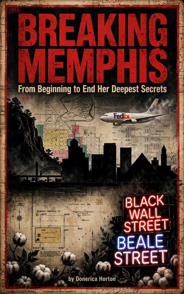
"Breaking Memphis" is a curiosity book by Donerica Horton with 14 chapters and approximately 22,584 words. Memphis land ownership, racial redlining, urban renewal, and enduring property patterns.
This book was created using Inkfluence AI, an AI-powered book generation platform that helps authors write, design, and publish complete books.
Frequently Asked Questions
What is "Breaking Memphis" about?
Memphis land ownership, racial redlining, urban renewal, and enduring property patterns
How many chapters are in "Breaking Memphis"?
The book contains 14 chapters and approximately 22,584 words. Topics covered include Why Memphis Rose on a Bluff, The Twelve-Cent Land Deal, Cotton Built on Enslaved Labor, Yellow Fever’s One-Dollar Auctions, and more.
Who wrote "Breaking Memphis"?
This book was written by Donerica Horton and created using Inkfluence AI, an AI book generation platform that helps authors write, design, and publish books.
Write your own curiosity book with AI
Describe your idea and Inkfluence writes the whole thing. Free to start.
Start writingCreated with Inkfluence AI


