
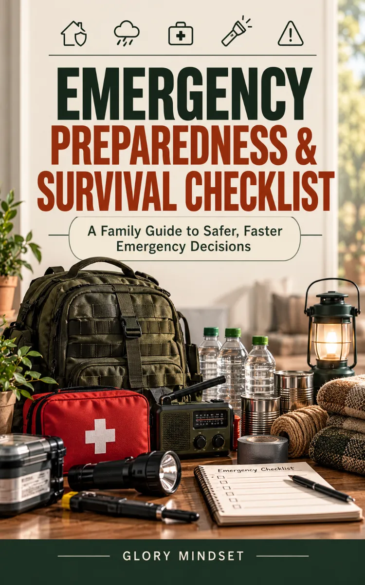

Read the first chapter
The whole of chapter one, free. About 18 min. Turn the pages with the arrows, your keyboard, or a swipe.
Chapter 1
Mapping Household Risks
Know What Can Reach Your Home
A wildfire evacuation order arrives while one parent is at work, one child is at school, and the family dog is at home. The nearest road looks familiar, but traffic has already blocked it. One phone has 12 percent battery left, and nobody remembers whether the family chose a meeting place outside the neighborhood. These problems grow quickly when a household has not made decisions before the emergency.
A useful plan starts with your actual location, not a generic disaster list. You need to know which hazards can affect your home, how officials will warn you, where your household members may be, and which routes lead away from danger. You also need a backup when phones, roads, power, or internet service fail.
The Home-to-Horizon Map gives you a simple way to build that plan. You will examine risks from your front door outward, connect each risk to an official alert source, and write a family communication and evacuation plan that people can follow under stress. By the end, you should have a one-page plan that answers four questions: What might happen? How will we know? Where will we go? How will we find one another?
Start by checking your county or city emergency-management website. Search for hazard maps, evacuation zones, flood information, wildfire information, shelter locations, and local emergency phone numbers. Your county may use different terms than a neighboring county, so use the information for the place where you live, work, attend school, or provide care.
Use the Home-to-Horizon Map in this order:
• Home: Inspect the immediate area. Note nearby creeks, steep slopes, wooded areas, industrial sites, rail lines, major roads, dams, and buildings that could create special risks. This step shows what can affect you before you have time to travel.
• Neighborhood: Identify streets that may flood, dead-end roads, bridges, narrow roads, and alternate exits. Drive or walk the routes during normal conditions so you recognize them later.
• Community: Find hospitals, fire stations, police stations, public shelters, schools, and pharmacies. Do not assume every listed location will open during every emergency; officials will announce which sites operate.
• Horizon: Look beyond your town. Identify a destination at least outside the immediate danger area, such as a relative’s home, a hotel area, or a designated public shelter. This gives your household a place to go if local roads or services close.
Next, match each hazard with a clear action. A flood may require evacuation before water reaches your street. A tornado usually calls for sheltering in a sturdy building away from windows. A hazardous-material release may require you to stay indoors and follow official instructions. “Be ready” does not tell your family what to do; “If the county orders evacuation, leave by Route B and meet at the library parking lot” does.
Write down the official alert sources for your area. These may include local emergency text alerts, county notifications, weather alerts from the National Weather Service, Wireless Emergency Alerts on compatible phones, local radio, and official county or city social-media accounts. Use more than one source because one system may fail or reach only part of your household. Sign up with the exact address where you live, and add work or school alerts when those organizations provide them.
Ask yourself: Could a person who feels rushed follow this plan without calling you for instructions? If the answer is no, replace long explanations with short decisions, named locations, and backup choices. Your practical takeaway is simple: map hazards from your door to the wider area, then connect every hazard to an official warning and a specific action.
Build the Family Communication and Evacuation Plan
A communication plan must work when family members separate. List each person’s normal locations and the best way to reach them. Include work, school, daycare, regular activities, and caregiving responsibilities. Ask schools and employers how they release people during emergencies. Record those procedures because a child may not be free to leave with any adult who arrives.
Choose two meeting places:
• Near-home meeting place: Pick a location outside the home, such as a neighbor’s driveway or a mailbox at the end of the property. Use it for a fire or another immediate danger when everyone can leave safely.
• Out-of-area meeting place: Pick a location beyond your neighborhood, such as a public library, community center, or relative’s home. Use it when roads, smoke, flooding, or damaged buildings make the neighborhood unsafe.
Choose one out-of-area contact who lives far enough away to avoid the same local emergency. Every household member should know the person’s full name, phone number, and city. During a regional disaster, local calls may fail while calls to another area work. Each person should send a short text such as, “I am safe at school. I am going to the approved pickup location.” Text messages may work when voice calls do not, but never delay evacuation while trying to make contact.
Use this communication plan as your written starting point:
Item Your decision
Near-home meeting place ______________________________
Out-of-area meeting place ______________________________
Out-of-area contact and city ______________________________
School or daycare pickup rule ______________________________
Work emergency contact ______________________________
Primary evacuation route ______________________________
Backup evacuation route ______________________________
Pet destination or caregiver ______________________________
Local alert website or phone number ______________________________
Set clear rules for evacuation. Leave when officials issue an evacuation order for your area, when emergency responders direct you to leave, or when staying creates an immediate danger. Do not wait for a family member to return home if officials tell you to leave. Use the agreed meeting place or destination instead. If you cannot evacuate safely, call emergency services and explain your location and needs. Do not drive around barricades or enter closed roads.
Plan for people who need extra help. A child may need an approved pickup person. An older adult may need transportation, medication, or mobility equipment. A person with a hearing, vision, speech, or mobility disability may need a specific communication method or accessible ride. Pets may not enter every shelter, so identify a pet-friendly hotel, boarding facility, veterinarian, or trusted caregiver before an emergency.
Store a paper copy of the plan in each adult’s wallet, in the children’s school information, and in a safe place at home. Keep an electronic copy only as a backup. A printed plan remains available when the power is out or a phone is lost. Review it when someone changes jobs, schools, phone numbers, addresses, or caregiving arrangements. The practical test is a short household drill: each person should state the alert source, the meeting places, the out-of-area contact, and the evacuation route without searching for the information.
Apply the Home-to-Horizon Map
Consider a household near a creek, a wooded hillside, and a two-lane road that leads toward town. One adult works 25 minutes away, a teenager attends a school three miles from home, and a dog stays at home during weekdays. The household wants a plan that covers flooding, wildfire, severe weather, and a power or phone outage.
Follow these steps:
• Check official local information. The household visits the county emergency-management website and finds a flood map, wildfire evacuation information, shelter announcements, and the county text-alert registration page. Expected outcome: the household knows which agency sends evacuation instructions and where to verify rumors.
• Mark the home and neighborhood risks. The household marks the creek, the wooded hillside, the low bridge, and the single road that may become blocked. It identifies a second route through a neighboring area. Expected outcome: the family knows that the low bridge cannot serve as its only escape route.
• Choose meeting places. The near-home meeting place is a neighbor’s driveway across the street. The out-of-area meeting place is a public library 12 miles away, outside the flood and wildfire areas identified on the local maps. Expected outcome: family members have a nearby option and a safer destination farther away.
• Assign communication roles. The teenager checks in by text with the out-of-area contact. The adult at work checks the county alert page and does not drive toward the danger area. The other adult handles the dog and carries the printed plan. Expected outcome: each person knows what to do instead of everyone making separate decisions.
• Set evacuation triggers. The household leaves when officials order evacuation, when responders direct them to leave, or when smoke, rising water, or a blocked route creates immediate danger. For a tornado warning, they shelter in the strongest nearby building rather than drive. Expected outcome: the family matches its action to the hazard.
• Practice the plan. On a weekend, the household drives both routes, times the trip to the library, and checks whether the dog can enter the selected destination. Each adult saves the county alert page and adds the out-of-area contact to the phone. Expected outcome: the family finds route problems and missing information before an emergency.
• Test without phones. Everyone uses the printed plan to name the meeting places and contact number. Expected outcome: the plan still works during a dead battery, power failure, or lost phone.
Quick checklist
• [ ] Check county, city, and state hazard information.
• [ ] Mark flood, wildfire, severe-weather, chemical, and transportation risks near home.
• [ ] Identify two ways out of the neighborhood.
• [ ] Register every household member for official local alerts.
• [ ] Save the local emergency-management website and emergency phone numbers.
• [ ] Choose a near-home meeting place.
• [ ] Choose an out-of-area meeting place.
• [ ] Select an out-of-area contact.
• [ ] Record school, work, daycare, and pet procedures.
• [ ] Write evacuation triggers in plain language.
• [ ] Print the plan and place copies where adults can reach them.
• [ ] Practice the routes and update the plan after changes.
A plan works when each person can state the next action without guessing. Test that result, not just whether a form looks complete.
Avoid Plans That Fail Under Pressure
Relying on one alert source
A single phone notification may fail because the phone loses power, the signal drops, or the alert does not cover your exact location. Social-media posts may also spread incorrect information.
Do this: Register for county or city alerts, keep weather alerts enabled, monitor official emergency-management pages, and use local radio as a backup.
Not this: Wait for a neighbor’s message or treat an unverified post as an evacuation order.
Choosing only one evacuation route
A familiar road may close because of flooding, fallen trees, smoke, a crash, or a police barricade. A route that works during a normal commute may not work during an emergency.
Do this: Choose a primary and backup route, then drive both during daylight. Mark bridges, dead ends, narrow roads, and places where you can safely turn around.
Not this: Assume a map application will provide a safe route during a disaster. Apps may show a road as open after officials close it.
Making contact the main goal
Family members sometimes delay leaving because they want confirmation from someone who has not answered. That delay can place them closer to danger.
Do this: Follow official evacuation instructions first. Go to the agreed destination, then send a short text when safe. Tell children and caregivers that leaving safely comes before making a phone call.
Not this: Drive toward a school, workplace, or home to collect someone after officials close roads or issue evacuation instructions.
Review the plan whenever your household changes, and practice it at least once each year. Keep the latest paper copy with your important household information. When you know the local risks, the warning signs, the meeting places, and the routes, an emergency becomes a set of decisions your family has already made. That preparation gives every later safety step a clear place to begin.
Set the context: why a numbers-based example matters
A checklist is only useful when you test it against real numbers: travel times, distances, capacities, and resource limits. Without numbers, a family can plan to "leave early" or "go to a hotel" and still get trapped by traffic, full shelters, or a pet no one can transport. This section fills that gap by showing how to convert your Home-to-Horizon Map into exact decisions you can act on under stress.
After reading this, you will be able to calculate realistic evacuation times, pick a reachable out-of-area destination, and size a simple car kit and fuel plan using plain measurements you can check on a phone or in a notebook.
Takeaway: concrete numbers remove guesswork. Write them on your printed plan.
Teach the core technique: turning risks into measurable actions
Use these steps to convert your map into actionable numbers.
• Measure route time at real conditions.
Drive your primary evacuation route during the hour you would likely leave (for example, 5:30 p.m.). Record the time: start-to-destination in minutes. Repeat the backup route. Why: traffic and stoplights change travel time; you need an actual minute count to compare routes.
• Calculate household loading time.
Time a dry run: the stopwatch starts when the first alert sounds and stops when the car is loaded and everyone is buckled. Include pets. Typical family of four with one medium dog often takes 12-18 minutes; record your actual time. Why: you will know whether you must leave immediately or can gather thicker supplies.
• Check fuel range and reserve.
Note your car’s fuel gauge reading and miles-per-gallon (MPG). If your primary route is 28 miles and your car averages 30 MPG with a half tank showing 120 miles range, you have a comfortable margin. Why: low fuel creates an evacuation failure point; plan to leave with at least 50-75 miles of range beyond the route length.
• Match destination capacity and distance.
Choose an out-of-area location at least outside the mapped hazard plus a buffer. Example rule: pick a refuge at least 15 miles beyond known evacuation zones or at least 30 minutes from your home under normal traffic. Why: some hazards spread; distance reduces shared risk.
Recap question: Given your route minutes, loading minutes, and fuel range, can you leave and reach your out-of-area place with margin for delays? If not, change one variable - faster route, earlier start, closer refuge - and retest.
Real-world scenario: suburban household with a creek and single bridge
• Measure and record:
• Primary route distance: 12 miles to library parking lot.
• Primary route drive time (5:30 p.m. test): 28 minutes.
• Backup route distance: 18 miles.
• Backup route drive time: 35 minutes.
• Household loading time:
• Dry-run measured: 15 minutes (two adults, two kids, one medium dog).
• Vehicle fuel and range:
• Fuel gauge at 1/2 tank; car MPG average 28; estimated range = 140 miles.
• Fuel needed to library and back via primary = 24 miles round trip; reserve target = 75 miles extra.
• Evacuation decision rule:
• If officials order evacuation AND loading time (15) + drive time (28) ≤ 60 minutes, leave by primary route.
• If the road to the primary route shows congestion or barricade, switch immediately to the backup route (35 minutes) and depart within 10 minutes.
Expected outcomes:
• Departure within 20 minutes of alert gets family to library in ~43 minutes total.
• With 140-mile range, car meets reserve rule (24 + 75 = 99 miles required margin; 140 > 99).
Quick checklist:
• Record drive times for primary and backup at likely departure hour.
• Time a full household loading drill (write the minutes).
• Note car MPG, current gauge, and range in miles.
• Pick out-of-area destination at least 15 miles beyond hazard maps or 30 minutes away.
• Write a simple leave rule: "If X alert AND load + drive ≤ Y minutes, go to Z."
Common mistakes and fixes
Underestimating loading time
People assume packing takes five minutes and leave cardboard lists. That underestimates kids, pets, and door checks.
Do this: Time a realistic full pack and add 20% margin. Record the actual minute count on your paper plan.
Not this: Guess how long it will take or pack only when the alarm sounds.
Ignoring fuel margin
Leaving with a near-empty tank creates optional failure when detours add miles.
Do this: Always target enough fuel to cover route length plus a 75-mile reserve (or at least enough for round trip plus 30%).
Not this: Rely on the low-fuel light or gas stations that may be closed or backed up.
Choosing a destination that fills quickly
Picking the nearest hotel without checking capacity or distance can leave you without options when demand spikes.
Do this: Pre-identify two out-of-area destinations (one 15-30 miles away, one 60-90 miles away) and note phone numbers and typical rates. Recheck availability during drills.
Not this: Assume a single destination will always have room.
Practical closing prompt: Take five minutes now to write three numbers on your printed plan - primary route minutes, household loading minutes, and current vehicle range - then run one quick drive-and-pack test this week to verify them.
When alarms, smoke, or rising water make decisions urgent, the households that act calmly already planned where to go, how to leave, and who they will contact.
Emergencies arrive without warning: a nearby fire that cuts off the road, a sudden storm that floods a low bridge, or a power outage that leaves phones dead. When people are scattered, one adult at work, a child at school, a pet at home, decisions made in those first minutes determine whether everyone gets out safely. A practical plan starts with your actual location and likely local hazards, not a generic checklist. Use the Home-to-Horizon Map to identify what can affect your household, how official warnings reach you, where people may be, and which routes lead away from danger. Build a one-page plan that answers four clear questions: What might happen? How will we know? Where will we go? How will we find one another?
Choose two meeting places: a near-home meeting spot you can reach quickly if leaving on foot or by car, such as a neighbour’s yard, a nearby landmark, or a safe open space outside the immediate danger; and an out-of-area meeting place beyond your local hazard zone, such as a relative’s home, a community centre, or a commercial area where accommodation is likely available. The out-of-area contact should live far enough away to avoid the same local emergency.
Keep a paper copy of the plan in each adult’s wallet, with caregivers and in a known place at home so it’s available during power outages or phone loss. Keep an electronic copy as a backup, but do not rely on it as the only source.
Check your vehicle’s fuel level and estimate range. Note the route distance and your vehicle’s typical fuel economy so you can judge whether you have a safe margin. As a rule, aim to leave with at least a reserve that covers the route plus an extra buffer (for example, a reserve of 50, 75 miles or the equivalent travel time), because detours and waiting can add substantial distance.
Set clear evacuation rules: leave when official authorities order evacuation, when emergency responders instruct you to leave, or when conditions (smoke, rising water, structural damage) make staying unsafe. Do not delay by waiting for a household member to return; proceed to the agreed meeting place or destination and have that person follow the plan or join you as soon as it is safe.
Practice the plan with short drills: have each person state the alert source, meeting places, out-of-area contact, and evacuation route without searching for information. Drive or walk both primary and backup routes during normal conditions, time a full household loading drill, and repeat tests when jobs, schools, phone numbers, or caregiving arrangements change.
[ ] Check official local and regional hazard information.
[ ] Mark flood, wildfire, severe-weather, chemical, and transportation risks near home.
[ ] Identify two ways out of the neighbourhood.
[ ] Register household locations for official alert systems available in your area.
[ ] Save the local emergency-management website or official contact numbers.
[ ] Choose a near-home meeting place.
[ ] Choose an out-of-area meeting place.
[ ] Select an out-of-area contact.
[ ] Record school, work, care, and pet procedures.
[ ] Write evacuation triggers in plain language.
[ ] Print the plan and place copies where adults can reach them.
[ ] Practice the routes and update the plan after changes.
Practical prompt: take five minutes to write three numbers on your printed plan, primary route minutes, household loading minutes, and current vehicle range, then run a quick drive-and-pack test this week to verify them.
Practical prompt: take five minutes to write three numbers on your printed plan, primary route travel time, household loading time, and current vehicle range, then run a quick drive-and-pack test this week to verify them.
Set clear rules for evacuation: leave when official authorities order evacuation, when emergency responders direct you to leave, or when conditions, smoke, rising water, structural damage, make staying unsafe. Do not delay waiting for a household member to return; proceed to the agreed meeting place or destination and have that person follow the plan or join you when it is safe.
Check your vehicle’s fuel level and estimate range. Note route distances and your vehicle’s typical fuel economy so you can judge whether you have a safe margin. Aim to leave with a reserve that covers the route plus an extra buffer, because detours and delays can add substantial distance.
Store a paper copy of the plan in each adult’s wallet, leave a copy with caregivers and at the children’s school or care provider if appropriate, and keep one in a known place at home so it’s available during power outages or phone loss. Keep an electronic copy only as a backup.
Choose two meeting places: a near-home meeting spot you can reach quickly if leaving on foot or by car, such as a neighbour’s yard, a nearby landmark, or a safe open space outside the immediate danger, and an out-of-area meeting place beyond your local hazard zone, such as a relative’s home, a community centre, or a commercial area where accommodation is likely available. Select an out-of-area contact who lives far enough away to avoid the same local emergency and share that person’s full name, phone number, and location with everyone.
Ask schools, care providers, and employers how they manage releases or evacuations during emergencies, and record those procedures. Some organizations require specific pickup steps or identification, and knowing them in advance prevents delays and confusion.
Write down the official alert sources for your area. These may include local government text or phone alerts, national or regional weather agencies, mobile emergency alerts, community radio, and official social-media or website accounts for your municipality or emergency office. Use more than one source because any single system can fail or reach only part of your household. Register alerts using the exact address where you live, and add alerts for workplaces or schools when those organizations provide them.
Start by checking local official information for each place your household uses, your town, district, or region. Look for hazard maps, evacuation zones, flood and wildfire guidance, shelter locations, and official emergency contact numbers. Administrative areas use different terms and systems, so gather the guidance that applies to where people live, work, study, or provide care.
End of chapter one. 9 more chapters in the full book.
Swipe or use the arrows to turn the page


What's inside: 10 chapters
- 1. Mapping Household Risks
- 2. Building Emergency Kits
- 3. Escaping Fire and Smoke
- 4. Responding to Earthquakes
- 5. Choosing Shelter by Hazard
- 6. Navigating Civil Unrest
- 7. Handling Urgent Medical Events
- 8. Managing Heat and Utility Loss
- 9. Avoiding Hazardous Exposure
- 10. Completing the Family Planner
About this book
"Emergency Preparedness & Survival Checklist" is a how-to guide book by Glory Mindset with 10 chapters and approximately 19,963 words. U.S.
This book was created using Inkfluence AI, an AI-powered book generation platform that helps authors write, design, and publish complete books. It was made with the AI Ebook Generator.
Frequently Asked Questions
What is "Emergency Preparedness & Survival Checklist" about?
U.S. family emergency preparedness, disaster safety, supplies, evacuation, and recovery
How many chapters are in "Emergency Preparedness & Survival Checklist"?
The book contains 10 chapters and approximately 19,963 words. Topics covered include Mapping Household Risks, Building Emergency Kits, Escaping Fire and Smoke, Responding to Earthquakes, and more.
Who wrote "Emergency Preparedness & Survival Checklist"?
This book was written by Glory Mindset and created using Inkfluence AI, an AI book generation platform that helps authors write, design, and publish books.
How can I create a similar how-to guide book?
You can create your own how-to guide book using Inkfluence AI. Describe your idea, choose your style, and the AI writes the full book for you. It's free to start.
Write your own how-to guide book with AI
Describe your idea and Inkfluence writes the whole thing. Free to start.
Start writingCreated with Inkfluence AI


